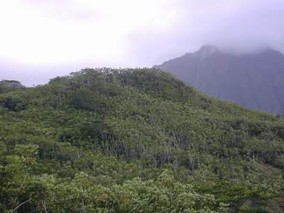
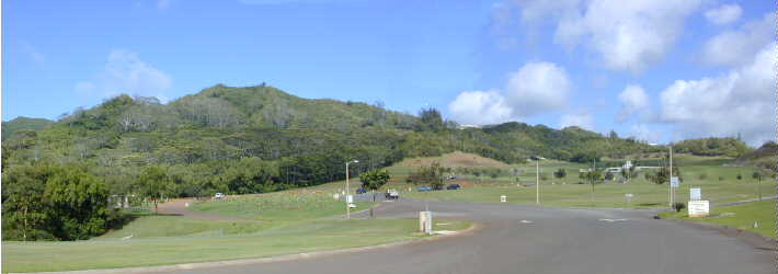
 Kawa Stream is a relatively short (~4.1 km), perennial stream located mostly in the Pikoiloa Tract of southern Kaneohe Town. The main or central branch of the stream arises within the National Veterans Cemetery and the stream eventually discharges into the south basin of Kane`ohe Bay. Kawa Stream has a drainage area of 4.0 km2 (1.56 sq. mile) that includes the National Veterans Cemetery and most of Hawaiian Memorial Park (cemetery), nearly all of the residential urban developments east of Kamehameha Highway from the cemetery down to Kaneohe Bay Drive (Piko`iloa, Kailuapuhi Waikalua Homesteads, Parkway), and the Bay View Golf Course. Although a windward stream, Kawa drains not the steep face of the Ko`olau (in Kane`ohe Ahupua`a the Nu`uanu Pali) but a ridge of hills (called Mahinui) that separates Kane`ohe from Kailua. The highest points on the watershed are two peaks on the ridge at 265 and 287 m (870 and 942 ft; shown in Photo 2; and seen in an aerial photo of Kapa`a Quarry). Adjacent watersheds include Kapa`a (to the east) and Kamo`oali`i (to the south and west).
Most of the drainage within Kawa watershed is handled by street storm drains that collect runoff into underground culverts that discharge into the stream. However, several small springs and numerous seeps maintain Kawa's base flow. Extensive parts of the stream channel are highly modified. A discussion of water quality and a listing of aquatic species living in Kawa Stream are provided elsewhere. Following are descriptions of each reach of the stream. The State Department of Health (HDOH) has recently (draft January 2001) completed a bioassessment of Kawa Stream.
Photo 2. The upper central branch of Kawa Stream arises in the swale now occupied by the Hawaii Veterans Cemetery, seen here from Hawaiian Memorial Park. The stream bed no longer exists in this area.
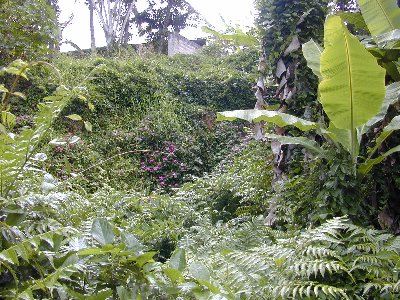
A parallel branch (upper east branch) drains the forested slopes immediately east of the cemetery. This forest is dominated by large and numerous smaller albizia trees (Paraserianthes falcataria) which provide the spectacular backdrop for the Hawaii Veterans Cemetery. Also common, and increasing in dominance downslope is Java plum (Syzygium cumini). The understory here is comprised of shoebutton ardisia (Ardisia elliptica), octopus tree (Schefflera actinophylla), and occasional hau (Hibiscus tiliaceus). Further east of this swale, the undeveloped hills behind Pikoiloa are mostly covered by an open forest of Schefflera. Groundcover in the albizia/Java plum forest is mostly a growth of basketgrass (Oplismenus sp.) and wood fern (Dryopteris sp.). There are also some garden plants here: Chinese evergreen (Aglaonema sp.) and an unidentified heliconia (Costus sp.) that suggest plantings made along an old track or road cut which parallels the normally dry swale. Although the incision of a channel is evident in the forest floor, this lacks a distinct bed and is completely covered with basket grass. This swale is joined by at least one other from the east, then joins the central branch just above a new culvert crossing constructed by Hawaiian Memorial Park for it's expansion annex.
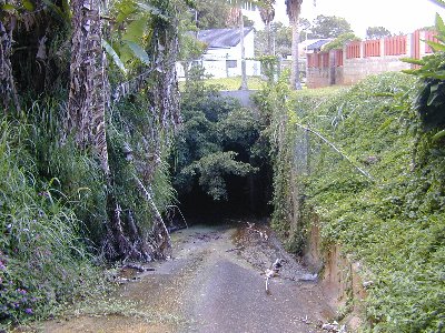
Scattered, small pools of water inhabited by melanid snails, are present just above the new cemetery annex road and box culvert. The forest here is mostly Java plum and an occasional mango (Mangifera indica). Although again only small, isolated pools are present below the box culvert, the channel of the stream is clearly evident as a steep sided incision 0.5 to 1 m deep. Downslope, this channel disappears into a grove of hau just above Kumakua Place in Parkway. Stream flow emerging from the hau is directed around the houses on Kumakua Place between two parallel hollow-tile walls. Here, the normally dry stream bed is overgrown with California grass. This "channel" terminates above a basalt rock face some 8-10 m high, partly covered by colorful arabian balsam or busy lizzy (Impatiens wallerana).
Another branch (upper west branch) arises in a swale behind the Hawaiian Memorial Park base yard (behind the upper end of Leleua Place). The margins of the ravine at the head end are quite high and steep.
 Kawa Stream is a relatively short (~4.1 km), perennial stream located mostly in the Pikoiloa Tract of southern Kaneohe Town. The main or central branch of the stream arises within the National Veterans Cemetery and the stream eventually discharges into the south basin of Kane`ohe Bay. Kawa Stream has a drainage area of 4.0 km2 (1.56 sq. mile) that includes the National Veterans Cemetery and most of Hawaiian Memorial Park (cemetery), nearly all of the residential urban developments east of Kamehameha Highway from the cemetery down to Kaneohe Bay Drive (Piko`iloa, Kailuapuhi Waikalua Homesteads, Parkway), and the Bay View Golf Course. Although a windward stream, Kawa drains not the steep face of the Ko`olau (in Kane`ohe Ahupua`a the Nu`uanu Pali) but a ridge of hills (called Mahinui) that separates Kane`ohe from Kailua. The highest points on the watershed are two peaks on the ridge at 265 and 287 m (870 and 942 ft; shown in Photo 2; and seen in an aerial photo of Kapa`a Quarry). Adjacent watersheds include Kapa`a (to the east) and Kamo`oali`i (to the south and west).


